
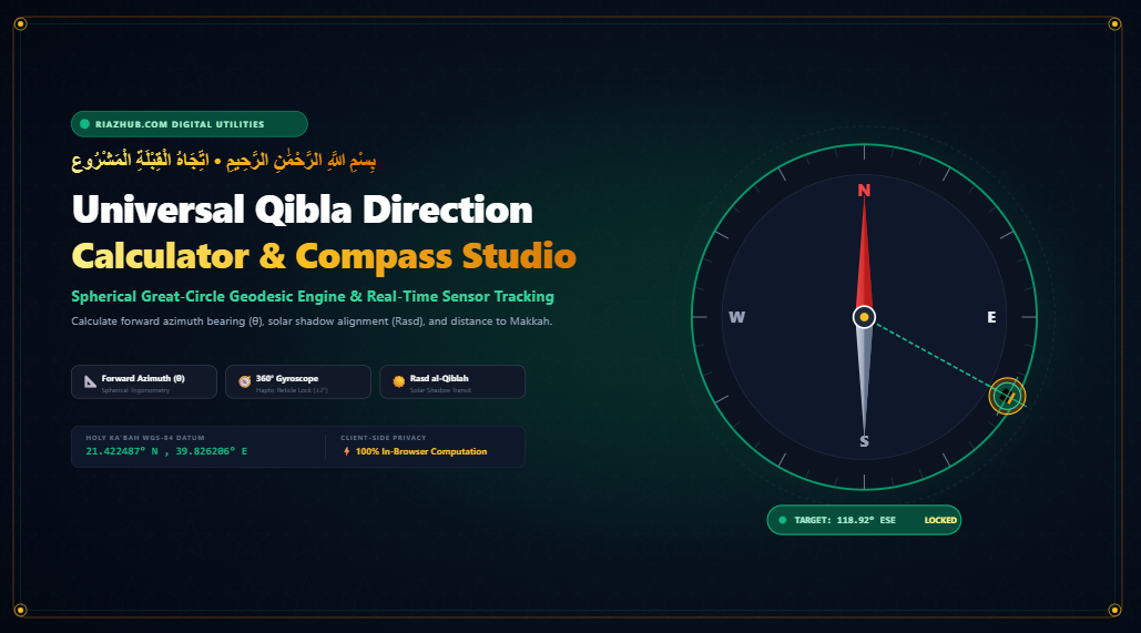
Facing the Holy Ka’bah in Makkah is a foundational prerequisite for the validity of Muslim prayer. Determining this direction across a three-dimensional curved spheroid has engaged Islamic astronomers, mathematicians, and cartographers for over a millennium. This comprehensive guide explores the mathematical formulation of the forward azimuth geodesic bearing equation, explains why flat Mercator maps mislead North American worshippers, analyzes the astronomical miracle of Rasd al-Qiblah (solar zenith shadow alignment), and demonstrates how the browser-based Universal Qibla Direction Calculator on RiazHub combines real-time smartphone gyroscope sensors with client-side spherical trigonometry to provide instant, millimeter-accurate orientation anywhere on Earth.
1. The Divine Injunction: The Obligation of the Qibla in Islamic Law
In Islamic jurisprudence (Fiqh), facing the direction of the Holy Ka’bah (Istiqbal al-Qiblah / استقبال القبلة) is categorized by unanimous consensus of all major Sunni and Shia legal schools as a non-negotiable condition (Shart) for the validity of the five daily obligatory prayers (Salah).
فَوَلِّ وَجْهَكَ شَطْرَ الْمَسْجِدِ الْحَرَامِ ۚ وَحَيْثُ مَا كُنتُمْ فَوَلُّوا وُجُوهَكُمْ شَطْرَهُ
“So turn your face toward al-Masjid al-Haram. And wherever you [believers] may be, turn your faces toward it.”
Surah Al-Baqarah (Holy Qur’an, 2:144)
Classical scholars distinguished between two degrees of facing:
- ‘Ayn al-Ka’bah (عَيْنُ الْكَعْبَة): Facing the exact physical stone structure of the Ka’bah itself with absolute precision. This is required for those praying inside Al-Masjid al-Haram within eyesight of the sanctuary.
- Jihaat al-Ka’bah (جِهَةُ الْكَعْبَة): Facing the general mathematical bearing or horizon toward Makkah for those living beyond sight of the sanctuary across global continents.
With modern satellite geodesy and mobile orientation sensors, any worshipper can now determine their exact forward azimuth angle to the Ka’bah within tenths of a degree using the free RiazHub Universal Qibla Direction Calculator.
🧭 Need to Determine Your Exact Qibla Right Now?
Activate your smartphone’s built-in digital compass with 1-click GPS auto-detection, live reticle alignment lock, and haptic feedback.
2. The Spherical Trigonometry of Qibla Calculation: The Forward Azimuth Geodesic
Because the Earth is an oblate spheroid rather than a flat plane, calculating direction cannot be solved using basic Cartesian geometry or simple planar arctangents. The shortest path between any two points on a globe is an Orthodromic Great-Circle Arc (the circular intersection formed by a plane passing through the two points and the exact center of Earth).
Exact Geographic Coordinates of the Holy Ka’bah
The mathematical anchor of the global Qibla coordinate datum (WGS-84 reference ellipsoid) is centered at the Holy Ka’bah within Al-Masjid al-Haram, Makkah al-Mukarramah, Kingdom of Saudi Arabia:
Longitude (lam_K) = 39.826206° E (+0.6950986 radians)
Earth Mean Radius = 6,371.0088 kilometers (3,958.7613 statute miles)
The Forward Azimuth Formula
Given an observer’s latitude $\phi_1$ and longitude $\lambda_1$, the forward azimuth bearing $\theta_Q$ (measured clockwise in degrees from True North, $0^\circ \le \theta_Q < 360^\circ$) is computed via the spherical law of cosines and napierian cotangents:
x = cos(ϕ_1) * tan(ϕ_Kaaba) – sin(ϕ_1) * cos(Δλ)
θ_raw = atan2(y, x) * (180 / π)
Qibla_Bearing = (θ_raw + 360) mod 360
The atan2(y, x) function computes the unambiguous four-quadrant angle, eliminating quadrant ambiguity across all hemispheres and international date-line boundaries. This exact algorithm is executed client-side inside the RiazHub Qibla Calculator engine with zero transmission of your coordinates to any external server.
Haversine Great-Circle Distance
To measure the exact spherical surface distance $d$ across the curved Earth from your current position to the Ka’bah, the Haversine formulation prevents numerical rounding errors at small antipodal separations:
Δλ = λ_Kaaba – λ_1a = sin²(Δϕ / 2) + cos(ϕ_1) * cos(ϕ_Kaaba) * sin²(Δλ / 2)
c = 2 * atan2(√a, √(1 – a))
Distance_km = 6,371.0088 * c
3. Spherical Great-Circle vs. Flat Map Projections: Why North America Prays Northeast
One of the most frequent debates among Western Muslims is the question: “Why do Muslims in New York, Chicago, and Toronto face Northeast toward Makkah when Saudi Arabia is south of North America on world wall maps?”
The misconception arises from the flat Mercator Projection. In 1569, Gerardus Mercator designed a cylindrical nautical chart to preserve angles of constant compass bearing (Rhumb Lines or Loxodromes). However, to keep lines of latitude straight, Mercator projection wildly distorts geographic areas and polar lines, stretching the northern hemisphere unnaturally wide.
| Origin City | Great-Circle Bearing (Shortest Arc) | Rhumb Line Bearing (Flat Map) | Spherical Distance Saved |
|---|---|---|---|
| New York City, USA | 58.5° (ENE / Northeast) | 103.2° (ESE / Southeast) | 1,240 km shorter via Great-Circle |
| Chicago, IL, USA | 48.6° (NE / Northeast) | 101.4° (ESE / Southeast) | 1,680 km shorter via Great-Circle |
| London, UK | 118.9° (ESE) | 122.4° (ESE) | 75 km shorter via Great-Circle |
| Jakarta, Indonesia | 295.2° (WNW) | 292.8° (WNW) | 110 km shorter via Great-Circle |
| Tokyo, Japan | 293.0° (WNW) | 278.4° (W) | 890 km shorter via Great-Circle |
If you pull a piece of string taut across a physical 3D classroom globe between New York and Makkah, the string does not angle southeast across the Atlantic Ocean. Instead, it arcs up through Canada and Greenland, crossing the North Atlantic into Western Europe and down into the Arabian peninsula. That initial forward launch direction is 58.5° (Northeast). This shortest line of sight through physical space is the universally recognized orthodox Qibla verified on the RiazHub Great-Circle Trajectory Studio.
4. The Solar Alignment Phenomenon: Rasd al-Qiblah (رصد القبلة)
Long before digital sensors and GPS satellites existed, medieval Muslim mathematicians like Al-Battani, Ibn al-Haytham, and Al-Biruni discovered an infallible optical method to verify the Qibla using only the sun and a vertical stick: Rasd al-Qiblah.
The Celestial Mechanics of Rasd al-Qiblah
Because the Ka’bah sits at latitude 21.4225° N, the Sun’s ecliptic solar declination ($\delta_{\text{sun}}$) matches this exact latitude twice every calendar year. When solar noon occurs at the Ka’bah on those two specific days, the Sun is positioned precisely at the celestial zenith 90° directly overhead in the sky above Makkah:
Occurrence 2: July 15–16 at 09:27 UTC (12:27 Makkah Solar Noon)
At this precise second, half of the entire planet Earth is bathed in daylight. If an observer anywhere in this sunlit hemisphere (Europe, Africa, Asia, the Middle East, and parts of North and South America) erects a perfectly vertical rod (gnomon) on level ground:
- Facing directly into the sun points with 100% optical purity toward the Ka’bah.
- The shadow cast by the vertical rod points in the exact opposite azimuth direction (along the Qibla axis line).
You can simulate and inspect today’s solar transit and shadow angles using the dedicated Solar Shadow tab within the Universal Qibla Direction Calculator on RiazHub.
5. Smartphone Sensor Calibration & Digital Compass Technology
Modern mobile devices integrate solid-state micro-electromechanical (MEMS) magnetometers, accelerometers, and rate gyroscopes. Understanding how these sensors communicate with your browser ensures peak accuracy when navigating to prayer.
True North vs. Magnetic North & Magnetic Declination
A magnetic needle points toward Earth’s Magnetic North Pole (located in northern Canada), which shifts constantly over time due to convection currents in the Earth’s outer liquid core. The Holy Ka’bah’s bearing, however, is calculated from True Geodetic North (Earth’s rotational geographic axis).
The angular difference between True North and Magnetic North at any given location is called Magnetic Declination.
- iOS Devices (Safari): Apple mobile devices calculate geomagnetic compensation internally and deliver the True North heading directly via
DeviceOrientationEvent.webkitCompassHeading. - Android Devices (Chrome/Firefox): Deliver raw geomagnetic orientation via
alpharotation. The RiazHub Qibla Calculator features a built-in Magnetic Declination Offset slider allowing users to adjust compensation based on their regional World Magnetic Model (WMM) value.
The “Figure-8” Sensor Calibration Technique
Mobile magnetometers can become polarized by nearby ferrous metals, magnetic phone clasps, laptop hinges, or building rebar. If your compass drifts or responds sluggishly:
- Hold your phone flat in the palm of your hand.
- Step away from large metallic objects or concrete pillars.
- Move your hand smoothly through the air tracing a wide, three-dimensional “Figure-8” pattern 3 to 5 times.
- This allows the operating system’s geomagnetic sensor to recalculate the ambient magnetic field and zero out local bias.
✨ Design & Share a Calligraphic Qibla Announcement Card
Generate high-DPI 1200×630 social media graphics in Luxury Emerald, Gold Arabesque, and Midnight Slate themes featuring your local bearing and the Quranic Qibla verse.
6. How to Use the RiazHub Qibla Direction Calculator & Compass Studio
Here is how to calculate and navigate your Qibla in three easy steps:
- Set Your Geographic Coordinates:
Click[ 🛰️ Auto-Detect My Location (GPS) ]to allow your browser’s native Geolocation API to populate your exact latitude and longitude down to 6 decimal places. Alternatively, click any major metropolis chip (Madinah, Cairo, Istanbul, London, Karachi, New York, Jakarta) or manually enter coordinates. - Connect Live Device Orientation Sensors:
On mobile devices, tap[ 📡 Connect Device Gyro & Compass ]and approve the sensor prompt (iOS 13+). Lay your phone flat on a horizontal surface or hold it level in your palm. - Rotate Until Target Reticle Locks:
Slowly rotate your body until the red magnetic needle points directly into the golden Ka’bah icon. When you are within $\pm 2^\circ$, the reticle pulses radiant emerald, the status changes to ALIGNED WITH KA’BAH! (المسجد الحرام), and your device provides a confirmation haptic vibration lock. - Export & Share:
Use the 1-Click Clipboard button to copy formatted coordinates and bearing angles, or switch to the Shareable Card Studio tab to download a high-resolution 1200×630 PNG card for WhatsApp, Instagram, or community bulletin boards.
7. Frequently Asked Questions (FAQ)
Q1: Is my GPS location or personal data sent to RiazHub servers?
No. The RiazHub Qibla Direction Calculator performs 100% of all trigonometric calculations, gyroscope tracking, and card generation inside your browser using vanilla client-side JavaScript and HTML5 Canvas. Zero GPS coordinates or orientation data leave your device.
Q2: Can I use this calculator on desktop computers without compass sensors?
Yes. On desktop computers, switch to the Manual Heading Dial tab. You can use the slider or $\pm 5^\circ$ stepper buttons to simulate rotating your heading and visualize how the compass dial aligns.
Q3: What if I pray while traveling on an airplane or train?
While on a moving vehicle, the forward azimuth bearing changes as your geographic coordinates progress along the journey. You can refresh your GPS position on the RiazHub Qibla tool at cruising altitude (with airplane Wi-Fi or GPS cache) to update the exact target vector.
Q4: How does night mode work on the tool?
Conclusion
Determining the Qibla is a union of sacred devotional reverence and rigorous astronomical mathematics. Whether verifying your home prayer rug, establishing orientation for a new mosque, or navigating in an unfamiliar city, the Universal Qibla Direction Calculator & Spherical Geodesic Compass Studio on RiazHub gives you the ultimate precision tools right in your browser.
🕋 Experience the Universal Qibla Studio Now
Free, instantaneous, sensor-calibrated, and private. Try the high-precision geodesic engine on RiazHub today.
Universal Qibla Direction Calculator & Real-Time Sensor Compass
Compute the exact forward azimuth bearing to the Holy Ka'bah from any coordinate on Earth via spherical geodesy, live gyroscope sensor tracking, and solar shadow alignment (Rasd al-Qiblah).
Great-Circle Distance (Shortest Path)
Rhumb Line Bearing (Flat Constant Angle)
Twice each year, the Sun reaches the exact celestial zenith over the Ka'bah (Declination = 21.42° N) at Makkah Solar Noon:
Anyone in the sunlit hemisphere observing a vertical shadow at this exact second will see it pointing precisely along the line of the Qibla.